We are specialized in:

Using a collaborative team approach, we facilitate structured workshops to bring subject-matter experts and Business departments together to define objectives and challenges for implementing GIS at an enterprise level. The results are a well-defined implementation schedule and a clear understanding of estimated costs and level of effort. The result of these efforts is a road map of prioritized spatial applications that establish a plan for moving an agency towards its overall objectives. Clients use these plans to obtain funding and move forward in an organized fashion, with the confidence that the pieces of their technology puzzle will come together. Using a collaborative team approach, we facilitate structured workshops to bring subject-matter experts and Business departments together to define objectives and challenges for implementing GIS at an enterprise level. The results are a well-defined implementation schedule and a clear understanding of estimated costs and level of effort. The result of these efforts is a road map of prioritized spatial applications that establish a plan for moving an agency towards its overall objectives. Clients use these plans to obtain funding and move forward in an organized fashion, with the confidence that the pieces of their technology puzzle will come together.
We are truly independent, and our advice is not tied to any specific product line. Instead, we focus on identifying the most favorable solutions for each client’s needs and desired outcomes. Our strategic-planning services will help you:

GeoLinks works with our clients to clearly define their unique needs through interviews, workshops, and online surveys. The information gathered is used in conjunction with the experience gained from other successful projects to scope a project with detailed technical specifications. Client will use the results to float the project for tendering. We are supporting clients in projects budgeting and proposals evaluations following international and local criteria. Our client will feel confident by ensuring that project is scoped to meet critical and prioritized business needs take in consideration current situation of business maturity, IT systems and available budgets. Also Client will feel confident guaranteeing the success by ensuring that the competent contractor and experts will implement the project.

GeoLinks understands that robust project management is one of main success keys for any project especially for projects have external stakeholders and Data dependencies. GeoLinks’ methodology in project management starts with creating project governance model identifying the roles and responsibilities of Business users, and escalation system up to senior management and project’s sponsors. The RACI model is one of the successful models that GeoLinks implementing during Business Requirements Analysis phase. The Quality management is one of the key project management areas that GeoLinks works on to ensure projects deliverables meets agreed specifications and client satisfaction within planned time. PMI is one of project management schools that GeoLinks follow its methodologies to ensure smooth implementation with proper documentations.
GeoLinks Offers Performance management service to clients after placing Enterprise Systems in production, especially for customized applications built for purpose. The performance management will ensure the optimal use of the implemented solution by business users and define the gaps and recommended enhancements to meet highest ROI. The RADAR approach is GeoLinks approach for implementing Performance Management services.
We understand that the challenges you face are unique to your company or to your industry. More often, the right solution may be a synthesis of several products from different vendors. GeoLinks recognizes the advantages of implementing tailored GIS solutions and COTS solutions depending on business case.

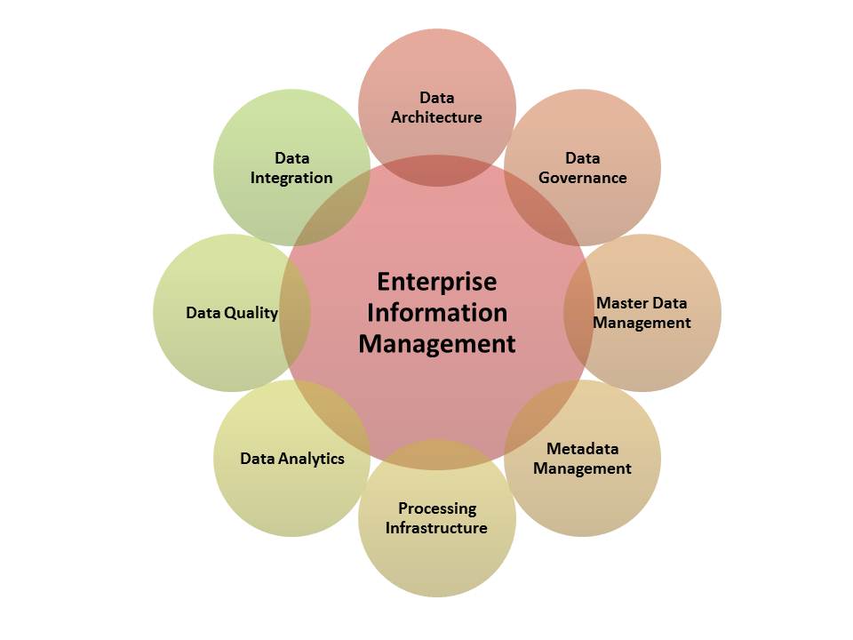
GeoLinks specialized in designing Geo Data Models for several industries, Extract/Transform/Load Data, Database Configuration and Administration, and Data Maintenance.
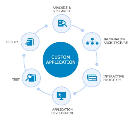
Following the technology trend for Applications platform and using the latest programing techniques, GeoLinks is your right partner for developing Web, Mobile and Desktop applications that are tailored for your business needs. GeoLinks is specialized in developing Decision Support Systems, Executive Dashboards, Data Maintenance Workflow, Native Mobile Applications for public and staff use, and Extensions of ArcGIS Applications.


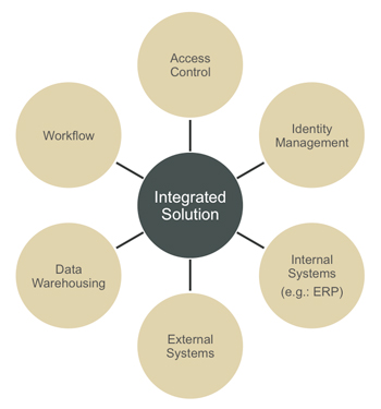
Integrating with core business systems will drive your entity to highest maturity level in utilizing the technology for improving customer services and internal business processes. GeoLinks implemented several integration projects with external governmental entities that shares data in web services or Data links.
GeoLinks is specialized in assessing the knowledge gaps and staff needs of your organization. GeoLinks is your right partner to support your Business with SMEs and domain specific consultants. GeoLinks offers short term and long term onsite consultancy after conducting the assessment of your needs.
GeoLinks offers customized courses focusing on the topics of your interest, Arabic or English speakers and materials upon request, and using your data as training Data. GeoLinks will help you prepare capacity building strategy over 2-5 years to ensure knowledge and staff growing in your organization synced with the maturity growing of your business.

Deep Learning and Artificial Intelligence (AI) techniques are transforming a range of sectors, including the government sector, into highly-intelligent decision-making entities. In particular, Artificial Intelligence (AI) methods achieve great success in many data analysis problems, such as Image classification and pattern detection . This is already applied to massive and complex data sets, which allows us to have intelligent transport systems, autonomous vehicles, early disaster alerts, and many other mission critical systems.
Fortunately, due to the availability of vast and high-resolution GeoSpatial data and efficient high-performance computing architectures, Artificial Intelligence (AI) techniques empower the GeoSpatial system to provide fast and near-human level perception. This lead to the rise of GeoAI, the newly emerging field that employs various forms of AI to the GeoSpatial industry.
Today, GeoLinks strives to support this transformation by helping the client to analyze, and make use of large amounts of GeoSpatial data in everyday decision making. Hence, we facilitate the adoption of GeoAI in fields like urban planning, Surveillance and Security, Assets management, … etc


